Yecheng County Travel

Xinjiang Yecheng County — the first city at the foot of the Kunlun Mountains, starting point of the Xinjiang-Tibet Highway. Explore the sacred spring hidden realm, decode ancient city mysteries, and experience border frontier charm.

219km
Zero Kilometer of Xinjiang-Tibet Highway
4000m
Average Altitude
3 Sites
Ancient City Ruins
200+
Natural Springs
Panorama of Yecheng Zonglang Sacred Spring
Yecheng County Zonglang Sacred Spring Landscape
Sacred springs and poplar trees complement each other at the foot of the Kunlun Mountains

Yecheng County Two-Day One-Night Border Expedition Tour

Visit the sacred spring hidden realm, decode ancient city mysteries, gaze upon the world's second highest peak

Duration
2 days / 1 night
Main Destinations
Sacred Spring, Mystery City, K2 Base Camp
Suitable For
Adventure enthusiasts, history researchers
Budget per Person
¥1000-¥1500
01
Hidden Realm Exploration
Zonglang Sacred Spring · Xitiya Mystery City
Highlights

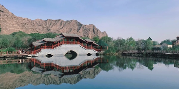
Arrive in Yecheng County, head to the Zonglang Sacred Spring scenic area. In the afternoon, explore the Xitiya Mystery City ruins and learn about the history of this enigmatic ancient city.

Attractions
Zonglang Sacred Spring
A natural spring group at the northern foot of the Kunlun Mountains, with clear and sweet water revered as holy water by locals, surrounded by poplar trees and wetlands forming a unique landscape.
Xitiya Mystery City
A mysterious ancient city ruin with unique architectural style and scarce historical records, with much debate in archaeological circles regarding its construction date and purpose.
Practical Info
Accommodation Recommendations
  • Yecheng Hotel
  • Zonglang Homestay
Food Recommendations
  • Kunlun Snow Chrysanthemum Tea
  • Yecheng Walnut Naan
  • Highland Yak Meat
Travel Tips
  • Spring water is drinkable
  • Do not touch cultural relics at the Mystery City
  • Beware of altitude sickness
02
Border Expedition
K2 Base Camp · Departure
Highlights

Head to the K2 Base Camp in the early morning to gaze upon the world's second highest peak. Visit the Xinjiang-Tibet Highway Zero Kilometer Monument in the afternoon and depart in the evening.

Attractions
K2 Base Camp
The north slope base camp of K2, the world's second highest peak, at an elevation of 3900 meters — one of the best locations to view this "Savage Mountain".
Xinjiang-Tibet Highway Zero Kilometer
The starting point marker of the Xinjiang-Tibet Highway (G219), the world's highest-altitude highway connecting Xinjiang and Tibet — a dream road for adventurers.
Practical Info
Equipment Suggestions
  • Warm Clothing
  • Sunscreen
  • Oxygen Canister
  • Hiking Boots
Souvenir Recommendations
  • Kunlun Snow Chrysanthemum
  • Black Goji Berries
  • Highland Honey
Important Notes
  • Border procedures required
  • High altitude, avoid strenuous exercise
  • Protect the ecological environment

Must-Try Foods in Yecheng County

Kunlun Snow Chrysanthemum Tea

A Yecheng specialty beverage, brewed from snow chrysanthemums grown above the Kunlun snow line, with a unique aroma and health benefits.

Yecheng Walnut Naan

A local specialty flatbread, naan mixed with walnut kernels — crispy and nutritious, an ideal dry ration for long journeys.

Highland Yak Meat

Yak meat from free-range herds on the Kunlun Mountains, firm in texture with a unique flavor, can be grilled or stewed — an excellent choice for replenishing energy.

Yecheng County Travel Tips
Best Time to Visit
  • Summer (Jun-Aug): Relatively mild climate
  • Autumn (Sep-Oct): Best visibility
  • Avoid winter when heavy snow blocks roads
Must-Try Experiences
  • Sacred Spring Water Experience
  • Mystery City Exploration
  • K2 Distant Viewing
  • Xinjiang-Tibet Highway Starting Point Photo
Budget Reference
  • Tickets: approx. 90 yuan
  • Accommodation: 300-500 yuan/night
  • Meals: 120-180 yuan/day
  • Transport: 300 yuan (off-road vehicle)
  • Total: 1000-1500 yuan
Frequently Asked Questions
  • Need a border pass? → Required for the Base Camp
  • How high is the altitude? → Base Camp approx. 3900m
  • Essential gear? → Warm clothing, sun protection
  • Suitable for elderly? → Recommend low-altitude attractions only

Explore Districts & Counties of Kashgar Prefecture